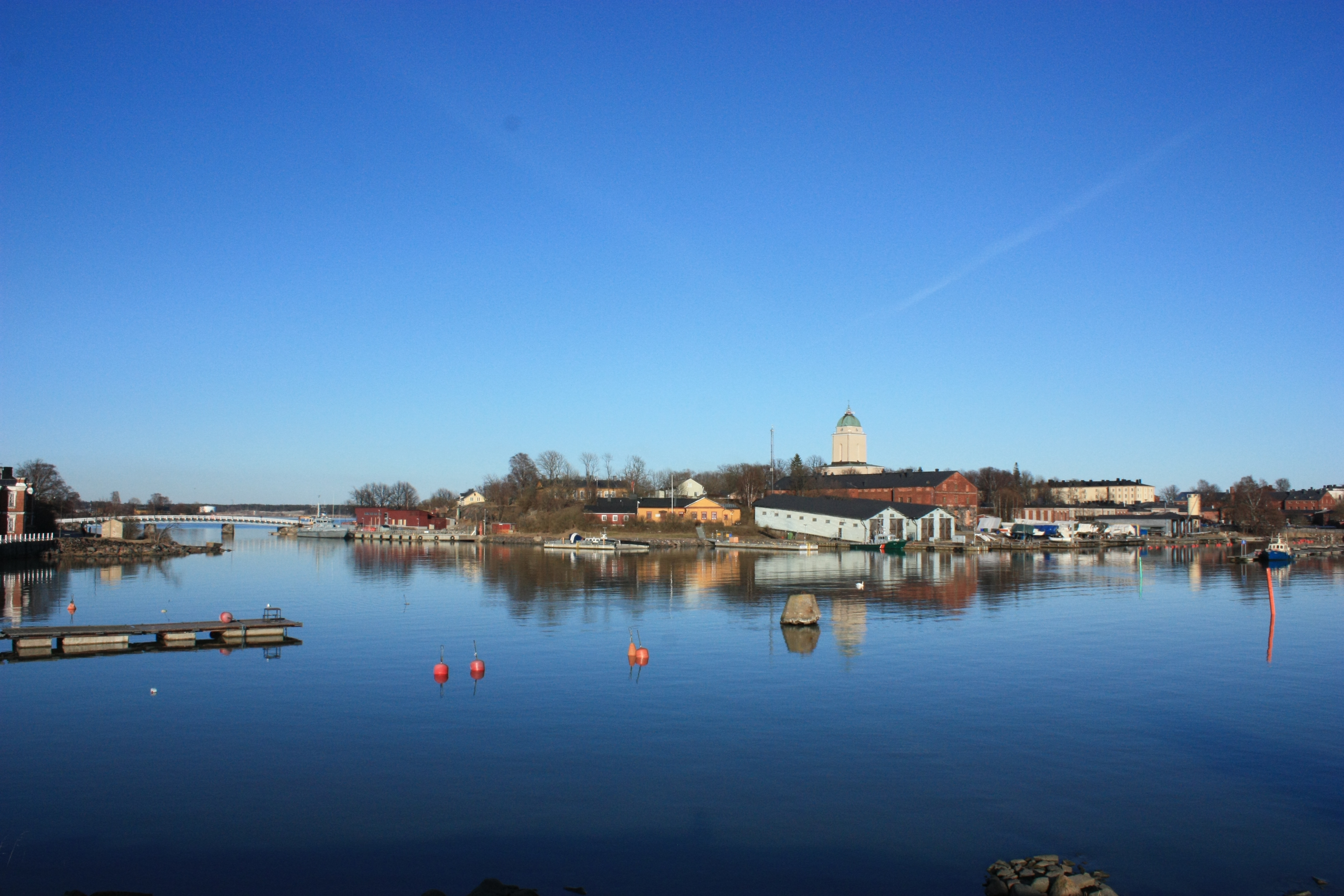
Suomenlinna wreck excavation 2024
"Hilma" Wreck, Western Mustasaari 2 (ID2694)
ㅤ
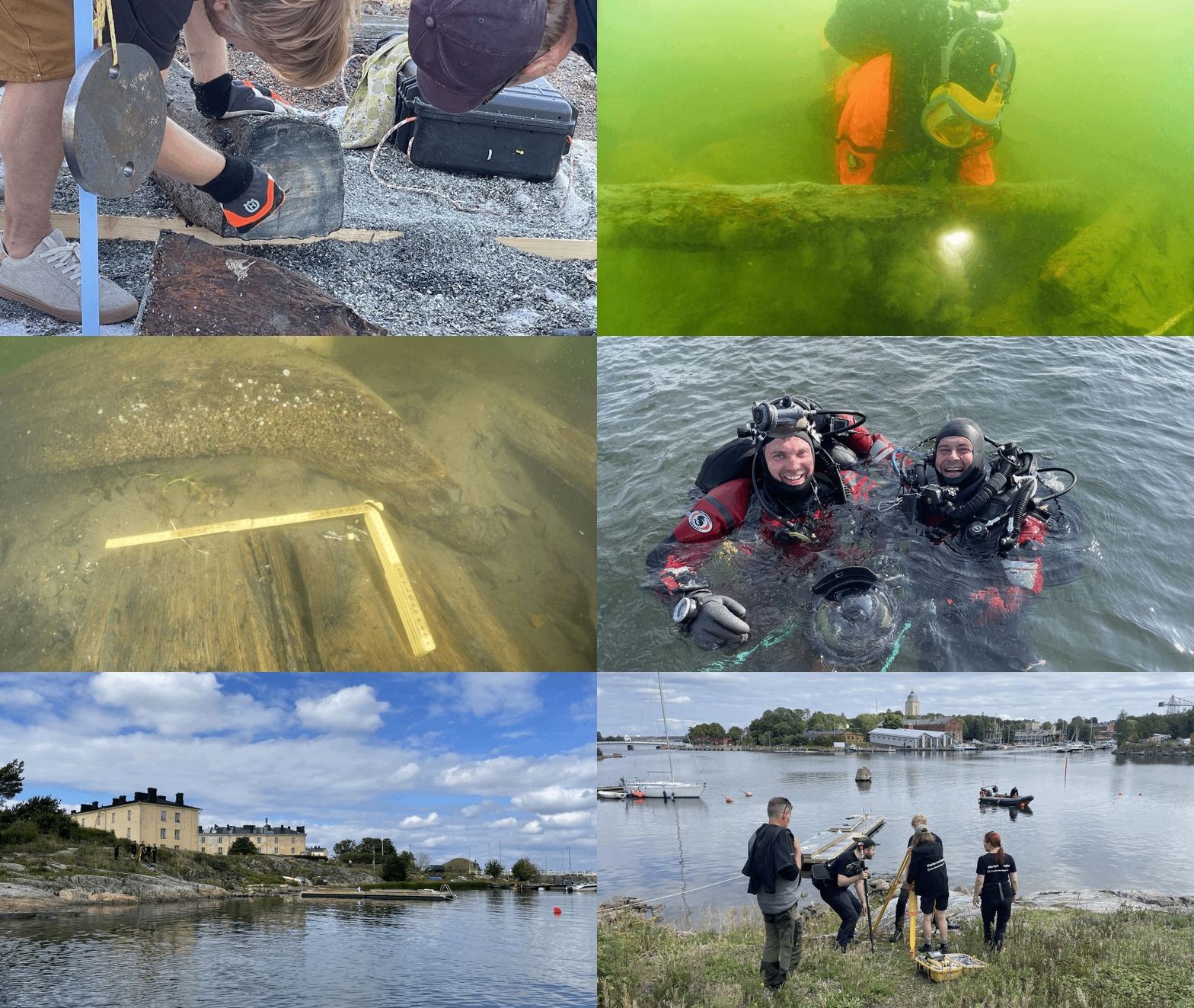
An excavation is a systematic investigation of an archaeological site or part of it using archaeological methods, during which the site is entirely or partially destroyed or dismantled. Key tasks of the excavation include exposing cultural layers and structures, observation and documentation, sample collection, and retrieval of finds. Following the fieldwork phase, there is a post-excavation phase, during which the accumulated material from the excavation is organized, analyzed, and interpreted. The excavation events, observations, and interpretations and conclusions based on the archaeological material are presented in the excavation report.
(Guidelines for the Quality of Archaeological Fieldwork in Finland 2020:23)
ㅤ
ㅤ
ㅤ
Research history
ㅤ
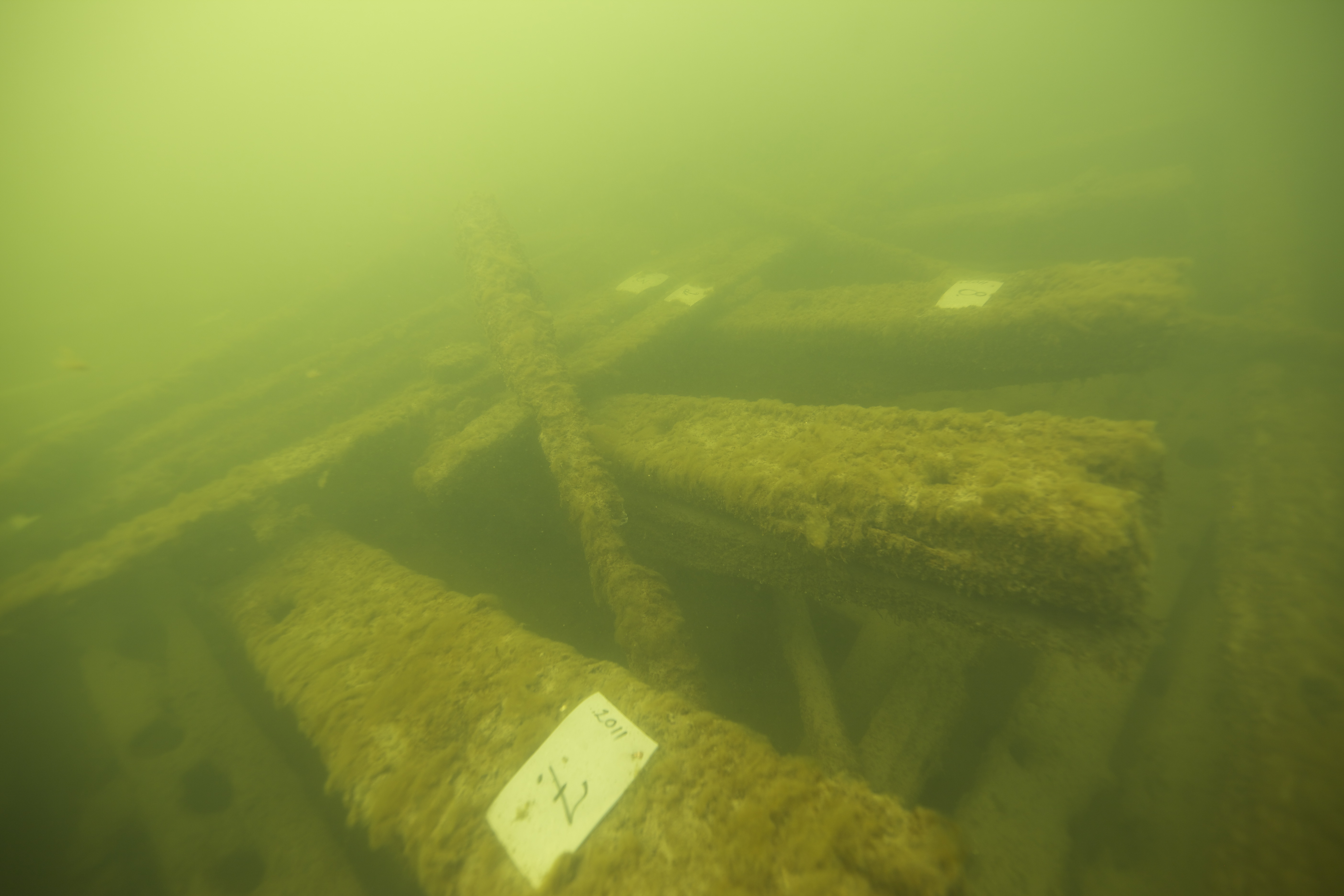
The wreck site was discovered based on a tip from a coast guard diver during the 2010 inventory of Suomenlinna's waters. At that time, the wreck was documented by photographing it. In the winter of 2011, samples were taken from the wreck for preliminary dendrochronological dating as part of Minna Koivikko's dissertation research on the wrecks of Suomenlinna.
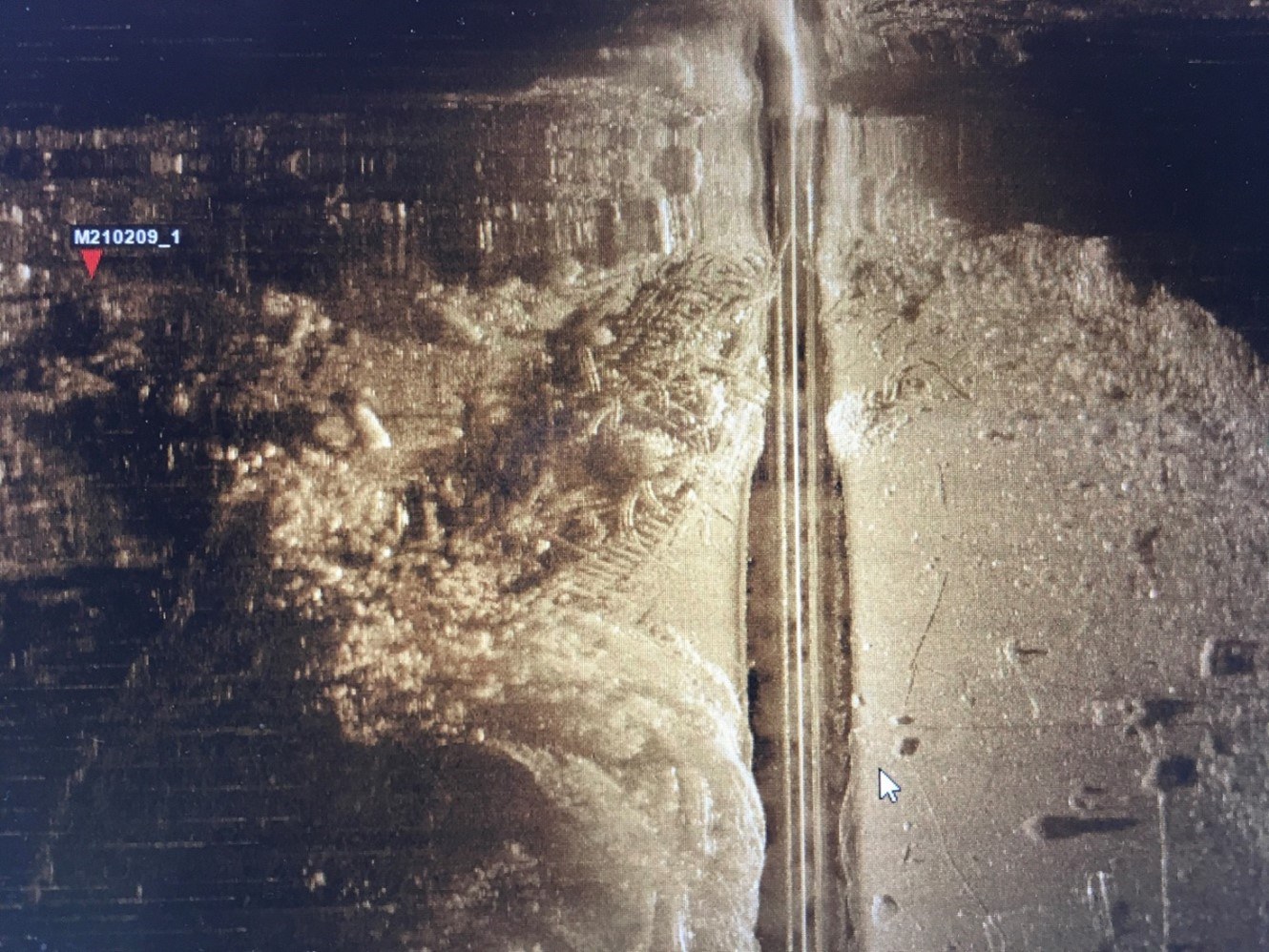
A team of volunteer divers assisting in taking the samples also photographed and took video of the wreck. Wood samples were taken from the planks, ribs, and beams. Some of the sawing of the samples was done on the surface, and the remaining pieces were returned to the wreck area. In addition to photos and videos, the wreck was documented using a scanning sonar device, making it the first wreck site in Finland to be documented this way.
The Finnish Cultural Foundation, that funded Koivikko's dissertation research, funded the analysis of the wood samples. The samples were analyzed by the Senior Specialist Pentti Zetterberg from the University of Eastern Finland. Preliminary dating results suggest that the wood originates from the northern coast of the Baltic Sea, with the last growth rings dating to 1780.
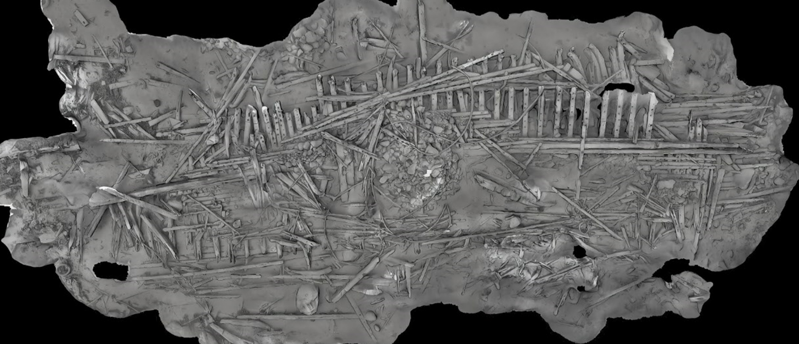
In 2019, the Finnish Heritage Agency conducted a side scan sonar survey of the area, detecting potentially related wooden debris south of the wreck over an area of 13 by 18 meters. In the winter of 2021, the wreck was systematically photographed, and a photogrammetric model of the site was created.
From 2022 to 2024, the site has served as a test field for environmental change, particularly regarding the temperature of the bottom sediment. The goal of this research is to understand how the wooden wreck affects its environment. It is widely accepted that water temperatures are rising due to climate change, making it important to investigate the role of wooden wrecks in this process.
ㅤ
ㅤ
Time and location of the excavation
ㅤ
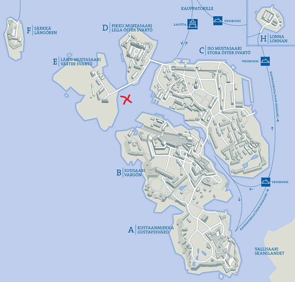
Excavation dates: 12.-23.8.2024
Map: Suokki-kartta-p.jpg (800×762) (stadissa.fi)
ㅤ
ㅤ
Media- and public day
ㅤ
Wednesday 21. August 2024
Media representatives 10:00-12:00
(registration: Lotta-Liina.salonen@museovirasto.fi)
Open public event 14:00-18:00 (no registration in advance)
Diving opportunity for P1 level divers 14:00-18:00
(registration: Lotta-Liina.salonen@museovirasto.fi)
Information about the excavation and research to be updated in Instagram @Sunkenheritage_fin
ㅤ
ㅤ
Preliminary interpretation
ㅤ
Dendrochronological analysis of the wreck suggests that the wood comes from the northern coast of the Baltic Sea with a preliminary dating to 1780. This suggests a possible connection to the Swedish Navy and Gustav III's war (1788–1790), although this interpretation is yet to be confirmed.
The initial interpretation of the wreck suggests it may have been deliberately sunk. This is indicated by large stones found inside the hull of the wreck that seem to have been used to sink the ship rather than as ballast. This interpretation is supported by the location and orientation of the wreck in a sheltered area and oriented towards the island, indicating intentional placement. It is possible the ship was sunk as part of an unfinished construction project. In this case, it could have served as a breakwater, creating a sheltered area between the shore and the reef. Another possible purpose for sinking might have been related to the plans of the former bridge of Susisaari.
Subsequent research focused on determining when the ship was repurposed as an underwater structure. If the Archipelago Fleet was involved in its repurposing, auction documents for rigging could provide valuable information. With the dating results, archival searches were narrowed to the period after the 1780’s, focusing on the records of the Helsinki Auction Chamber. These searches were conducted by maritime history students from the University of Helsinki under the guidance of maritime historian Mikko Huhtamies. Unfortunately, no additional information about the wreck was found from the archive.
Another lead was found on a map identifying a vessel named Victoria near the wreck's location on the southern shore of Iso Mustasaari, near the current authority dock. Associate Professor Marcus Hjulhammar discovered a 1795 newspaper advertisement of the auction of a barge named Victoria. This barge was built in Pori (Björneborg), that is in the area indicated by the dendrochronological results. Perhaps the ship was not sold and was sunk instead. Should the wreck at Western Mustasaari be Victoria, it would have been less than 15 years old at the time of the auction. This is relatively young for a barge type known for its longevity. Additionally, a ship named Victoria is not found in the Archipelago Fleet's list of vessels.
Yet another possible clue to the wreck's history comes from reports suggesting that the Swedish fleet, that surrendered in 1808, was stationed in Satamalahti during the Russian period. However, this information is unconfirmed and comes from a single source. Were it accurate, the wreck could be one of the 110 ships handed over to the Russians. In terms of size, it could be a Turunmaa-class frigate.
ㅤ
ㅤ
Description of the research site
ㅤ
"Hilma," officially known as the Länsi-Mustasaari Wreck 2 (ID 2694), is located on the eastern side of Länsi-Mustasaari. The wreck measures approximately 33 meters in length and eight meters in width. It is situated opposite the island of Susisaari and the entrance to the dry dock, at a maximum depth of six meters.
The research area is in a reasonably sheltered bay, with the wreck positioned between a shallow rocky islet and Länsi-Mustasaari. The wreck is easily accessible from the shore. To the south, a narrow opening to the sea allows waves from the open sea to enter the bay. Historically, this area was known as Satamalahti.
The wreck is a typical skeleton wreck of a wooden shipwreck found in Suomenlinna, with only the bottom part preserved. Loose structural parts lie on top of the bottom section. The identity of the wreck is still unknown.
Loose structural parts lie on top of the bottom section. Due to its location, the wreck has been continuously exposed to significant human activity. The ongoing research project aims to develop methods for more accurate interpretations of the numerous wooden wrecks surrounding the fortress.
ㅤ
ㅤ
Research team
ㅤ
The team is led by maritime archaeologist Minna Koivikko, the project manager of the "Veteen vajonneet" project. The group consists of the Finnish Heritage Agency's maritime archaeology team: Riikka Alvik, Sami Brchisky, Jesse Jokinen, and Kalle Virtanen.
The excavations also include other experts from the "Veteen vajonneet" project, namely Kari Hyttinen (photogrammetry), Mikael Holmström (shipbuilding), Hannu Matikka (Archipelago Fleet), Kalle Salonen (underwater excavation), Kati Laasonen (diving safety), Ari Ruuskanen (maritime biology), Tuomas Aakala (dendrochronology), and Liisa Näsänen/Elisa Ahverdov from the National Museum's conservation department.
Additionally, Karri Hirvonen, Saara Mohammadi, Emma Barrow, Sabina Kraaz, and Veli Leino have been hired for the excavations with the support of the Svenska Kulturfonden. Interns from the University of Helsinki, Lotta-Liina Salonen and Janne Huovinen, are also part of the research team.